Route details, maps, pubs, features, local history and folklore for a wide variety of walks focusing primarily on Norfolk and Suffolk

Tuesday 25 September 2018

Somerset Coast Path - Bridgwater to Cannington

Salt marsh

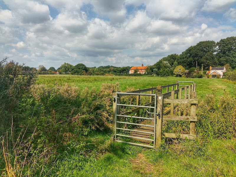
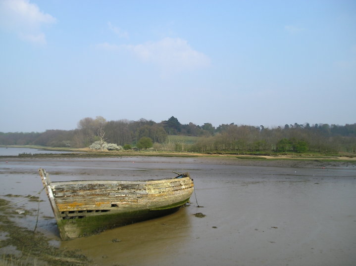
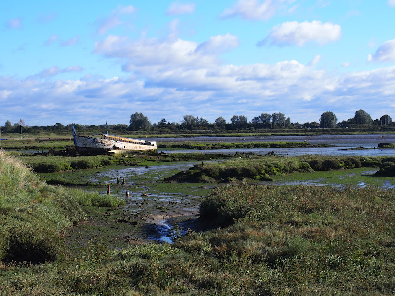
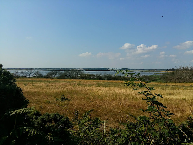
A walk along the banks of the River Parrett from Bridgwater to Cannington

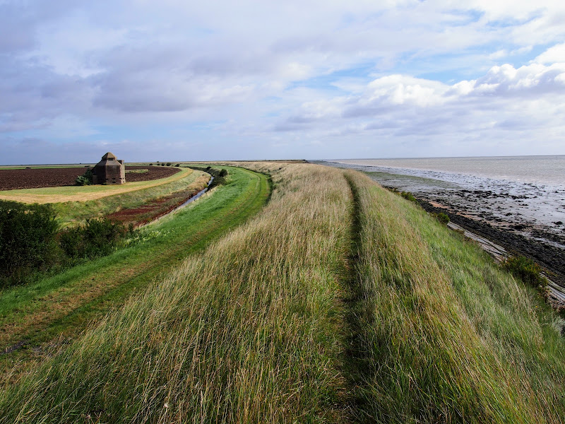
This 9 mile walk is part of the Somerset section of the England Coast Path and follows the defence banks of the River Parrett from Bridgwater to Cannington. Although the village of Cannington is not exactly on the river, it does provide a public transport link back to Bridgwater and there are clear paths and tracks that link the trail to the village.

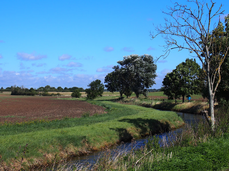
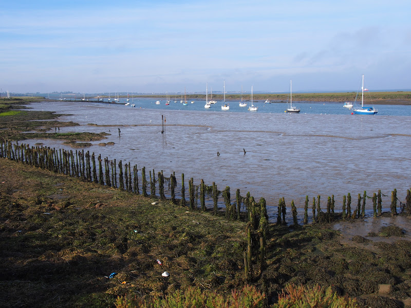
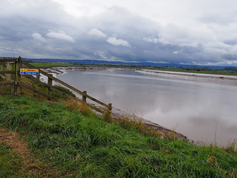
The River Parrett at this point is a wide tidal estuary with long slow winding bends in its course as it navigates to the sea. WWII Pill boxes sit around each bend, strategically placed to guard against the threat of German invasion up the river. The fields on either side are pastureland for cattle and sheep and once beyond Dunball there is little sign of civilisation. The river is notable for its lack of craft, the docks of Bridgwater and Dunball, collectively known as the Port of Bridgwater, are now long gone so no commercial traffic utilizes the water course. Even pleasure craft are notable by their absence.

It should be noted that at the time of this walk report, September 2018, there was a series of works along the river bank necessitating marked diversions. According to the order notices these works will be in place until mid 2019. The diverted paths are not immediately clear and one should follow the roped lines and the seemingly out-of-place red road signs that direct pedestrians.

The route from the defence banks to Cannington uses a footpath clearly marked on OS Maps. It should be noted that this path is a some distance beyond where it is marked on the map and one should continue to the field boundary where there is a stile, then follow the farm track.

As with many defence paths, the grass banks in this instance were in particular need of a trim. Overnight rain had left the vegetation sodden resulting in very wet feet. No matter how many times boot manufactures indicate their footwear is waterproof, experience proves that no boot is completely waterproof. Just remember that it is only water and feet and boots soon dry out. Just enjoy the walk, the seclusion and the landscape.

Sunday 23 September 2018

Somerset Coast Path - Brean to Bridgwater

Salt marsh

A walk along the Somerset Coast from Brean to Bridgwater

This walk starts by taking one of the many paths from the coast road through Brean to the broad sandy beaches that dominate this area. In this instance it uses the path opposite the Unity Holiday Camp, the name being taken from the former farm whose land it sits upon.

The England Coast path uses the beach all the way through to Burnham-on-Sea passing the iconic low lighthouse, a wooden structure that sits on stilts on the beach at the north end of Burnham. It is just past this landmark that one may find the path cut off by the tide. Don't attempt to go through to the sea wall ahead as there is no public access. Instead, take the path through the dunes and follow the track indicated on this route.

From Burnham the path follows the estuary of the River Parrett which rises some 37 miles away at Chedington in Dorset and is tidal for the majority of its course to the sea. All along this coast are the reminders of an industrial past. Burnham pier, which is no more than a stump these day, once was the railway terminus where both freight and passengers could be loaded onto ships. Burnham station was just across the road and what is now Marine Drive was the route of the od railway line from Highbridge. Reminders still adorn the roadside. The station sign. The old signalbox. A semaphore signal.

Soon after, as the path negotiates the marshes around the River Brue there are more reminders of the railway. This area was the Highbridge Wharf and used to house the Somerset and Dorset Joint Railway locomotive works. The works closed in 1930 and the Wharf is now no more than moorings for pleasure craft.

From this point there is a lengthy section following the winding estuary river where little is seen other than the wide open landscape. Make sure you have plenty of water and food. The grass river banks provide plenty of opportunity for a picnic.

Bridgwater town cannot be seen until one is in the town, its presence maske by the industrial outskirts. Dunball presents the first encounter of urbanisation where the path enters the old Dunball Wharf area and more reminders of its railway history with lines still sitting in the concrete ground. This was once a busy area and part of the Port of Bridgwater. As one will notice during this walk, the river is devoid of craft in the modern day and the docks and the railways are all just another chapter in history.

Wednesday 19 September 2018

Brean Down Circular Walk

Salt marsh

A Short walk around Somersets Brean Down

Brean Down is a 100m high promontory at the northern end of the Somerset Coast Path. This rocky outcrop protrudes some 1.5 miles out into the Bristol Channel and centred between the sandy bays of Brean and Weston Super Mare. The land is currently owned by the National Trust and provides both wildlife habitat and the remains of a Victorian fort, recommissioned in WWII, that sits at the head.

The walk is under 3 miles in total. There is a steep initial climb although this is up well maintained steps that most able bodied folk can negotiate. The effort is rewarded by the amazing views from the top with a panoramic scene stretching along the coast southwards with the distant Quantock hills making way for the tall cliffs of Devon. Northwards gives views of the extensive beaches around Weston Super Mare and to the west are the islands of Flat Holm and Steep Holm with Barry Island marking the closest point on the welsh coast beyond.

The Fort at the end of the promontory is maintained by the National Trust with information boards throughout and representatives on hand to offer guidance and information. Entrance is free and one can spend a good hour just wandering through these extensive remains.

Tuesday 4 September 2018

Wenhaston Circular Walk

Salt marsh

A ramble of the heaths and commons around the Suffolk village of Wenhaston

This walk is one of Suffolk's hidden secrets that will not fail to impress. The village of Wenhaston lies on the back road between Blythburgh and Halesworth and is probably missed by most folk travelling in this direction.

The village is centred on a number of ancient heaths and commons which have now becomes havens of nature and which this walk navigates around. Blackheath, Church marshes, Bickers Heath are all visited on this specific walk. There is also the traditional pub in the Star Inn, unspoilt and well worth visiting for its food and range of ales. There is also a reputedly haunted area known as Peggys Stile which is located where the footpath exits onto the road just up from the pub. A stile no longer exists at this location but local folklore warns of the ghostly spectre of Peggy who, depending upon the version that is told, was either a witch or donkey.

The highlight of the walk is at the end, namely St Peter's church which hosts an artwork known as the Wenhaston Doom. This magnificent painting, which depicts the Last Judgement, dates from the late 15th century and was reputedly painted by a Blythburgh monk. The painting was discovered during Victorian restoration of the church in 1892 when the decaying whitewashed wooden boards above the chancel arch were taken down and left outside, some say to be used as firewood. That night it rained and the whitewash was washed away revealing the painting which had been hidden since the time of the reformation. What is remarkable about this painting is that, unlike other surviving medieval art which were painted onto plaster, this is still bright and vivid and is the only such example in the country.

Thursday 30 August 2018

Runton and Incleborough Hill Walk Sumary

Salt marsh

Short circular walk over Incleborough Hill in North Norfolk

Incleborough Hill stands above the villages of East and West Runton on the North Norfolk Coast. At 260 feet in height and covered with low level gorse bushes it provides magnificent unobstructed views across the coast from Cromer to Sheringhamm and beyond. One cannot help but be impressed and in awe at the sight.

The walk is not arduous and apart from a short climb up steps it is achievable by most able bodied folk. The return is down a much gentler slope to West Runton and to the coast to follow the Norfolk Coast path back to East Runton.

Tuesday 28 August 2018

Essex Coast - Burnham-on-Crouch to Southend

Salt marsh

A walk around creeks and countryside of coastal south Essex

The start of the walk is a call to the ferryman. He is based on the far side of the River Crouch and a telephone call has him sailing across in no time. The ferry drops its passenger on Wallasea Island which sets the scene for the day. It is an island but only separated from the mainland by a creek. This low level land is full of creeks, dykes, ditches and it is difficult to determine what is an island and what is part of the mainland.

For this walk we navigate across to the village of Paglesham and then down to the banks of the River Roach which we follow up to the town of Rochford. One could simply catch the train at Rochford and return to Burnham. It wouldn't be a bad idea if you are following this route as the remaining leg to Southend is predominantly urbanised and not a pleasure to walk. The alternative to taking the road is to follow the creeks through to Shoeburyness but that is a whole days walking in itself.

There are limited places for refreshment along this route. There is the Punch Bowl pub at Paglesham but this has limited opening hours. In this instance we returned to Burnham-on-Crouch where the Queens Head is a little back street pub that specialises in micro brewery ales which are rare to find in this part of Essex, in fact any ale of any description is hard to find in this part of Essex.

Sunday 26 August 2018

Sandlings Walk - Rushmere to Melton Walk Summary

Salt marsh

The Suffolk Sandlings path between Rushmere, on the eastern side of Ipswich, and Melton

The Sandlings is a long distance path linking Ipswich and Southwold through the Suffolk Coast and Heaths Area of Outstanding Natural Beauty.

A starting point is provided at Rushmere Heath, close to Ipswich Hospital and takes a rural route out behind Kesgrave and through to Martlesham. The trail then heads down to Martlesham Creek, a sizeable creek off of the River Deben that creek was said to be used in 18th century smuggling days as a discreet place to offload contraband. A riverside path then provides access all the way through to Melton. This is the highlight of the walk, a true delight to wander no matter what time of the year.

Although there are no specific pubs along the route, a short diversion gives access to The Black Tiles at roughly the half way point. There is public transport linking the two ends with 800 First Group bus service departing from outside Melton railway station. The 64 service follows a similar route and departs from The Street in Melton. There is no Sunday service.

Features along the route include an anonymous grave on Martlesham Heath known as Dobbs' Grave, reputedly the resting place of a shepherd boy named Dobbs who committed suicide. The area is purported to be haunted some saying it to be the ghost of Brainy Dobbs, an airman from Martlesham Heath airfield.

Martlesham Heath Control Tower Museum is located a little further along and pays homage to RAF Martlesham Heath, which contributed to the development of aviation as well as being a key airfield during two world wars. Open on Sundays from Easter to October.

The impressive renovated Tide Mill sits on the banks of the Deben at Woodbridge and is a worthwhile attraction to take time out and visit. The mill, over 800 years old, is said to be the oldest in the country.

Essex Coast - Burnham-on-Crouch to Bradwell Walk Summary

Salt marsh

A 15 mile walk along the remote Essex coast from Burnham-on-Crouch to Bradwell

Many publications have stated that the section of the Dengie peninsular that borders the sea, east of the town of Burnham-on-Crouch, is the most remote place in the entirety of England. It is true that this isolated area of Essex is far from any major centres of population but walking this coast path one is never completely devoid of the signs of civilisation. Although one may never meet another soul on this lonely path, there are farms and machinery working the fields, haystacks and narrow lanes heading inland. All evidence that civilisation is not far away and, indeed, the nearest town is never more than 5 miles away as the crow flies.

The route is predominantly defence banks with a panorama of flat marsh to one side and acres of flat farmland on the other leaving with just the defence bank the tallest structure around. This leaves one distinctly exposed to the elements and faced with wind and rain it can require additional effort to push onwards. There are wide areas of cut grass on the landward side of the banks which can be utilized as a sheltered walking refuge when the going becomes a struggle or when the top of the bank is overgrown as found it some sections in this instance.

It has to be said that the constant unchanging scenery of this flat landscape can become somewhat monotonous as the miles slowly slip away. The smallest of landmarks then become a haven for curiosity. A sluice gate. A WWII pill box. Discarded tyres and debris in the marsh mud. The skeletal remains of a ship rotting on the marsh. A metal 5 bar gate with numerous plastic pieces of jetsom and flotsam seemingly purposely tied to it cluttering the mind with wonder as to its intentions.

The final part of the walk leaves the coast to navigate up the lanes to the village of Bradwell. There is a bus service from here although buses are few and far between. The D4 service returns to Burnham-on-Crouch. The alternative, as in this instance where accommodation was at St Lawrence is the D1 Service which links Bradwell, St Lawrence and the village of Latchingdon where the regular 31 service proceeds to Burnham-on-Crouch.

Thursday 23 August 2018

Essex Coast - St Lawrence to Tillingham Walk Summery

Salt marsh

A 16 mile walk along the Blackwater estuary from St Lawrence to Tillingham

The area that is bordered by the Blackwater Estuary to the north and the River Crouch to the south is known as the Dengie peninsular, a somewhat isolated area of marsh and low lying farmland. The remoteness of this area is its beauty and given the clear blue skies and a little warmth in the air this can be a true delight to walk.

The route detailed here heads along the Blackwater estuary, passing Bradwell nuclear power station as the coast slowly curves around from the estuary to face the open sea. In the distance, Mersea island is easily seen and sitting on the mudflats as river meets sea, visible at low tide, are a line of concrete filled barges that were sunk to provide a sea defence for the marshes. Further along is the remote St Peters Chapel, the oldest church in England and said to have been constructed in AD654. It is a working place of worship and well worth the visit into its humble and peaceful confines.

It is at this point that the long distance trail known as St Peters Way reaches its destination. This 45 mile trail starts at Chipping Ongar and passes through the Essex country side and villages in its journey to the coast. This well waymarked trail serves as the return for this route to St Lawrence. The trail leads across the low lying fields and marsh into the village of Tillingham arriving through the church yard. There is a pub on the green where one can rest ones weary legs before the final stage back to St Lawrence.

The St Peters Way slowly climbs to some 30m after leaving Tillingham, and this provides glorious views of the coastline. The route departs the trail at St Lawrence to follow a country lane out onto the main road. This is busy and caution should be observed when walking along this short section to the road down to St Lawrence Bay. There is a footpath marked on the OS that would negate this section. However this was certainly inaccessible when walking the route in September 2017. .

Wednesday 22 August 2018

Essex Coast - Maldon to St Lawrence Walk Summary

Salt marsh

A walk along the southern side of the Blackwater estuary from Maldon to St Lawrence

This 16 miles walk provides great views of the Blackwater estuary with vast open panoramas of the tidal river. Mudflats and gulleys provide havens for wildlife and there are numerous old dilapidate river craft that sit decaying into the mud, forgotten and forlorn.

The path navigates around the numerous creaks and inlets that abound this southern side of the estuary. The path uses the compacted river defence banks which makes it hard on ones feet and offers no shelter from the elements. Given a brisk breeze and light showers, it can take its toll on ones enthusiasm as the path winds in and out of the creaks through to Maylandsea, at times seemingly navigating in the wroing direction.

This specific route does offer a shortcut out of Maylandsea by following the St Peters Way path. This links Lawling Creek and Mayland Creek and provides a short but welcome change of scenery.

The route ends at the Waterside Park in St Lawrence. This provided touring accommodation for those wanting to explore this coastline. Having said this, the park was taken over in December 2017 and it is uncertain whether touring sites are still available. Recent Trip Advisor reports are not encouraging.

Note that public transport in this area is very limited and most major roads can be choked with traffic especially at rush hour. There is a limited bus service between St Lawrence and Maldon.

Few of the pubs and bars offer any real ale and it was a unexpected discovery to find that the modern Blackwater Bar provided a very good example of St Austells Proper Job ale. Admittedly this is far from its Cornish homeland but in the ale desert of this part of Essex it was a just reward for days walking.

Saturday 18 August 2018

The Sandlings Walk - Knodishall to Sizewell Belts

Sizewell Belts

A 9 mile circular walk that links Knodishall and Sizewell Belts along Suffolk's Sandlings Trail

An easy walk across the typical heaths and commons of Coastal East Suffolk that make up the Sandlings. There is woodland, marsh, and rambling sandy heath full of flora fauna and wildlife.

NOTE: The section from Sizewell through to Leiston Common, Sizewell Belts is no longer part of the official Sandlings path. It has been rerouted along the beach in front of the power station and then through Kenton Hill woods. This Sizewell Belts walk as described here is still accessible using permissive paths.

Friday 17 August 2018

Stour and Orwell Walk - Cattawade to Shotley Gate Walk Summery

Salt marsh

A walk along the Stour estuary following the Stour and Orwell long distance path.

The Stour and Orwell Walk is a long distance trail that follows the estuaries of South Suffolk. This 42 mile trail links Felixstowe and Manningtree and this specific walk is the southern most section that follows the north side of the River Stour estuary. There are some superb views across the wide waters that separate Suffolk and Essex and although there is not full access along the waterfront, the route provides a pleasant days ramble to the head of the Shotley peninsular. This specific route also diverges from the official route to take in the village of Erwarton, a quiet and tranquil Suffolk community that is a pleasure to meander through.

The route is waymarked throughout although it is advisable to use an OS map or GPX tracker software to clarify the route in a few specific points where the way onwards becomes ambiguous. Do check tide times as there is a short section along the beach by Sutton Ness which can become inaccessible during periods of high tide.

The main limitation of this walk is the transport access between the two ends. There is no direct bus service and one needs to use Ipswich as a link. Having said this, the services do allow ample time to perform the walk.

It is advisable to take food and drink as there are little opportunities to purchase any on the route, with the only pub encountered being that at the end of the walk.

Thursday 16 August 2018

Rendlesham Forest and Butley Walk Summary

Salt marsh

A woodland walk, a UFO encounter, quiet country lanes and a good old country pub

This is a great way to spend a day exploring. Rendlesham forest has many trails created by the Forestry Commission in order to discover this working forest. However this trail goes off piste to discover a little more. The first notable thing of the walk is the runway close to the car park. Although now redundant, this was a RAF air base that was taken over by the USAF and was a key hub during the Cold War. The forest surrounding the base is renowned as the location of a UFO encounter by US military that occurred during December 1980 and the Forestry Commission have a trail dedicated to this. The first part of this route heads out along this trail to view the UFO sculpture that depicts the craft encountered at one of the alleged landing sites. Some claim that the forest is still subject to strange unearthly occurrences so tread carefully!

The route heads out to view the curious sculpture which substitutes as the village sign for the village of Capel St Andrew. This iron man was commissioned at the millennium and created by local sculptor Paul Richardson. It is said to represent St Andrew as a fisherman, with his left hand clutching an eel whilst his right holds a fish. He is surrounded by oak trees that once covered this landscape and at his feet is a chapel from which the word capel is derived.

The walk also pays a visit to the ruins of Butley Abbey which dates from the 12th century. All that is left is a tall arch from the original church building which is now hidden away within a group of farm buildings. Further north is the impressive building of Butley Priory which was originally a 14th century gatehouse to the abbey. These days it is renovated and used as a wedding venue.

More information on the UFO encounter can be found at An Extended Walk around the Rendlesham UFO Trail.

Wednesday 15 August 2018

Aldringham Fen Walk Summary

Salt marsh

A Short Circular Walk around Aldringham Fen

This is one of Suffolk's little secrets, hidden away from roads and off the beaten track. Tranquillity is guaranteed and there are some times of the year when one can walk around the entire route without seeing a soul. The area known as Aldringham Fens is a secluded haven of nature and wildlife, an area of marsh and reed-bed fed by the Hundred river which passes to the southern side of the fens.

It is thought that the fen may have possibly been the result of medieval peat extraction. It is known that before the railway arrived The Fens were a continuation of what is now Thorpeness Mere, the whole area being a vast shallow expanse of salt marsh. The railway provided an embankment to separate the Mere from the fen and the Mere became the modern day boating lake as part of Glencairn Stuart Ogilvie's early 20th century vision of a creating an idyllic Seaside village by the sea.

Access to the walk is via a footpath from Aldringham through to the picturesque Aldringham church. This is a pleasant path through an undulating Suffolk coastal countryside. The path continues down to the fen through more country side before circumnavigating the wetland by footpaths across boardwalks, across heath and through woodland . Return is back via the church.

This walk can equally be accessed from the village of Thorpeness, navigating along the side of the Mere to North Warren where there is access onto the Fen path.

Friday 10 August 2018

Leiston to Buxlow Church Ruins - Walk Summary

Salt marsh

A country ramble to the lost parish of Buxlow

This walk provides a days ramble to view the ruins of Buxlow church. Many may have never heard of the parish of Buxlow, even those local to the area, and they can be forgiven for their ignorance since the parish was consolidated with Knodishall on 22nd February 1721.

Little is left of Buxlow church, which was dedicated to St Peter. There is merely a remnant of a wall from the old round tower that now rests in the garden of a domestic house which is viewable from the track that runs between the two houses. There are suggestions that the church was one of those recorded for Knodishall in the Domesday book and records certainly show there was a rector of the parish from 1301 onwards. By the middle of the 17th century it was reported to be 'decayed and ruinated tyme out of mind' although a rectors of the parish were still being recorded up to 1716 when Robert Witchingham held the honour.

Whilst admiring this piece of history the lady from the adjacent house engaged us in conversation stating that there have been many archaeological finds in the fields to front of the ruins. She even remarked of the many Roman coins that were constantly being unearthed. This is certainly not recorded on the Suffolk Heritage website so this is merely word of mouth. This does spark the imagination as the nearby hamlet of East Green is one of the suggestions of the long lost Roman station of Sitomagus. Maybe there was a connection from East Green to Aldringham which local folklore states was was a Roman port, the river Hundred in those days said to be navigable to sea going ships.

Note that a similar walk is described on this site with an alterntive route. This can be found on the page titled A Walk Around the Churches of Knodishall and Friston.

Thursday 9 August 2018

Saxtead and Earl Soham Circular Walk Summary

Salt marsh

A country ramble through rural Suffolk taking in the villages of Saxtead and Earl Soham

This walk can be described as a typical Suffolk rural ramble. Quiet country lanes and accessible footpaths make this suitable for anyone.

Highlights begin almost immediately with the working Saxtead Green Post Corn Mill, preserved and maintained by English Heritage. As the route descends into Earl Soham there is the 13th century church of St Mary which is well worth visiting. The village of Earl Soham is a real piece of picture postcard Suffolk with its broad leafy main street providing an air of tranquillity. At the western end the road passes across the River Ken which is no more than a babbling brook that feeds into the River Deben.

At the edge of the village is the traditional old pub known as The Victoria. Unspoilt and unmodernised, this is a delight to visit. It once hosted a brewery, but due to demand it was moved across the road and has subsequently moved out of the village although it still supplies the pub with its traditional local ales.

Leiston to Reckford Circular Walk Summary

Salt marsh

A circular walk encapsulating Leiston Airfield, Theberton woods and the Minsmere River

Few may have heard of Reckford and indeed as a location it is pretty much lost in the landscape. There is a Reckford Road in the neighbouring village and there is a 16th century Reckford Farmhouse and there is the Reckford Bridge but to all intents and purposes the community of Reckford is not recognised, just a small area of the village of Middleton. Whether the area was ever judged to be a village is unknown. Nonetheless we will make it the destination of this circular walk.

The walk has much to feast ones eyes upon. The former WWII Leiston airbase commonly known as RAF Leiston hosted the USAF 357th Fighter Group who were locally known as the Yoxford Boys. Little is left although there is a memorial that pays homage to the US crews that flew out of this airfield and never returned. There are some hidden remnants in the landscape, a broken up runway that crosses the farmland, old buildings that have camoflaged themselves in the undergrowth and now either lie redundant of have been put to use as farm buildings.

The walk continues onto the broadleaved woodland known as Theberton Woods before navigating down the quiet country lanes and tracks to Reckford.

Return is along the banks of the Minsmere river to Eastbridge then back to Leiston via the Abbey ruins.

Saturday 4 August 2018

Weavers Way - Stalham to Aylsham Walk Summary

Salt marsh

A walk along the dismantled M&GN railway from Stalham to Aylsham

This walk is the Railway section of the Weavers Way, a 60 mile long distance trail through the eastern side of Norfolk. This section follows the former M&GN railway trackbed from Stalham to Aylsham and there is plenty of evidence of the former railway with the stations of Honing and Felmingham still retaining their platforms and some structures and many typical railway style bridges throughout the trail.

Originally named as the Great Yarmouth and Stalham Light Railway when the first section was constructed in 1876, it changed its name to the Yarmouth and North Norfolk Light Railway with the extension to North Walsham in 1878. In 1881, in conjunction with the Lynn and Fakenham Railway a link between Melton Constable and North Walsham via Aylsham was added together with the light railway being converted to a full standard gauge line.

The 20th century saw this railway amalgamated into the Midland and Great Northern Railway, before combining into the LNER grouping. Post war saw its merger into the nationalised British Rail.

The line lasted until 1959 when it was deemed to be loss making and, along with many of Norfolk's railways, it closed down for good. The former railway line has now become part of the Weavers Way long distance trail as well as a designated county wildlife site and the cutting close to Felmingham has become a butterfly nature reserve.

The former railway has to be left at North Walsham where the modern road uses its route through the town. This provides a half way point of this walk and enables the hiker to peruse North Walsham as well as provide plenty of places to rest and refresh oneself before continuing onto Aylsham. The Hop Inn is always a recommended place to visit for those who like their ale. This micro pub serves six ever changing ales along with simple snacks and is always a hub of activity with conversation being the main entertainment of its customers.

There is no direct public transport link between the two ends of this walk and one requires to either use Cromer or Norwich as a link. In this instance Sanders Buses offers the number 6 service from Cromer to Stalham and to return there is the 44 servcie from Aylsham to Cromer.

Tuesday 31 July 2018

A Walk to Baconsthorpe Castle Walk Summary

Salt marsh

An easy walk to view the ruins of Baconsthorpe Castle with return route to Sheringham

The remarkable ruins of the moated and fortified 15th century manor house known as Baconsthorpe Castle lie to the south of the village of Bodham on the main A148 road close to Holt. Footpaths and lanes provide access through to this isolated wonder that lie hidden in the Norfolk landscape. The Castle is currently under the tenure of English Heritage and entry is totally free. The landscaped area is surrounded by a picturesque moat and information boards document the history of the ruin. This really is something worth visiting so allow at least an hour to peruse this piece of Norfolk history.

In order to get to the start of the walk, there is a frequent seven day a week bus service linking Sheringham and Bodham. After navigation to the ruins, the return is via the village of West Beckham where there is the Wheatsheaf pub for lunches and refreshment. A footpath leads down to the main road from where permissive paths through Sheringham Park provide an interesting and pleasant route through to Upper Sheringham. This route follows the parks Temple Walk and then continues onto Park Road to emerge back on the road at Upper Sheringham. The park is open from dawn to dusk and outside of these hours one is required to walk down the B1157 which has no pavement making a hazardous route, particularly during holiday periods.

There are pavements between Upper Sheringham and the main town and the walk ends at the bus stop adjacent to the North Norfolk Railway station.

Sunday 29 July 2018

Leiston to Hazlewood Circular Walk Summary

Salt marsh

A somewhat challenging circular walk to Suffolks ancient parish of Hazlewood

Hazlewood was an ancient parish that bordered the River Alde in the Plomsgate Hundred of Suffolk. In 1934 it was annexed with the neighbouring parishes of Friston and Aldeburgh although names in the landscape still bear testament to its existence, including Hazlewood Common, the ultimate destination of this walk.

This is a challenging walk in respect of 20 yards of jungle to navigate through in order to get to The Grange farmhouse. Navigation of this neglected footpath does involve crawling on all fours as well as climbing across fallen trees. Not a walk for the feint hearted.

This challenge borders a field which was part of a WWI airfield that was in operation between October 1915 and September 1919. Known locally as Hazlewood Aerodrome, this grass airstrip was one of several support sites for RNAS Great Yarmouth and served as a night landing ground. It was also used by aircraft responding to Zeppelin raids. Little remains of the site as all support buildings have now either been demolished or collapsed although there is reputedly some concrete footings that can still be seen.

Other features on this route are the ancient Great Wood and some post medieval quarries. Return is across Aldringham Common where the former Aldringham Providence Baptist Chapel can be seen. Built in 1812, this chapel hidden away on the common was replaced in 1915 with a design by the Suffolk architect, poet and artist, Cecil Howard Lay. It has since been converted into a private residence.

Walk Summaries

Latest walk summaries are basic information sheets for walks that have yet to be fully documented. These provide links to maps, public transport and walks stats, although detailed notes and features are not included.

Latest Walk Summaries

Featured Walk

In Search of Sizewell Chapel

A 10 mile walk following the southern side of the parish boundary of Leiston in Suffolk This walk follows the route of a 17th century peramb...

What is GPX

All you need to know about GPX, electronic mapping and how to use modern apps and mobile devices as navigation devices

Popular Walks

Maps