A Walk Around the Churches of Knodishall and Friston (Diversion in Place)
WARNING
There are footpath diversions in place on this path. Follow the diversion signs when walking this route.
More information can be obtained on the East Suffolk Public Rights of Way Access page.
Friday, 4 January 2019
|
1 comment
|
![]()

An 8.4 mile circular walk around the Suffolk villages of Knodishall and Friston
An easy ramble across the Suffolk countryside, with the highlight being the hidden ruins of St Peters Church in the old parish of Buxlow, now a part of Knodishall. There's some fascinating history on this walk along paths that are off the beaten track but nonetheless well maintained.

Walk Statistics
- Start location: Leiston
- Distance: miles ( km)
- Total Gain: ft ( metre)
- Total Descent: ft ( metre)
- Min Height: ft ( metre)
- Max Height: ft ( metre)
- Est. Walk Time:
- Walk type: Circular
- Walk Grade: Easy
- Terrain:

Maps
The following maps and services can assist in navigating this route. There are links to printed maps and links to downloadable GPX route data for importing into navigational software and apps.
- Ordnance Survey Explorer Map
- OS Explorer 212 - Woodbridge & Saxmundham
- GPX Route File
Walk Notes
The main intention of the walk was to visit the Buxlow church ruins on Knodishall Green. This long lost church is even a surprise to local folk such are the times we live in and it would appear local folklore and knowledge is dwindling and the idea of exploring on foot something which many discount. I have had many verbal comments proffered such as I never knew about that
. This all goes to show that one should explore ones locality before jumping into a motor to explore distant parts from the sanctuary of a metal box.
The ruins are located in the garden of a domestic house, with only the eastern end of the chapel still standing amidst the well presented lawn. The garden is surrounded by a hedge but the ruin is still viewable. Unfortunately on all the occasions that I have walked this, I have never encountered any of the residents to ask permission for a closer inspection. I have met the neighbour who related that there have been many metal detectorists over the years who have unearthed many finds including Roman coins in the fields beyond.
A chance meeting with an old local of the parish once relate an old tale about the ruins. He declared that on many occasions a phantom shadow has been seen to come out of the ruins, cross the road and go down into the pond opposite. The pond is in the neighbouring house and is used as a swimming pool during the summer months and even incorporates a make shift diving board. However there are tales of the old Manor house just down the road being known as the Ghost house or Ghost Hole, so it may be connected with this. Unfortunately this old tales are slowly dying with the older generations.
This walk also visits Friston church, a lovely compact village chapel. This is impressive in the fact that there is a carved wooden coat of arms of James I displayed on the wall together with a 16th century Bible cover. It just goes to show that Suffolks churches are always full of wonder, history and interest.
Whilst walking around this route one cannot help but notice the numerous large pits that litter the landscape. Some of these are huge chasms in the flat farmland, some are small round hollows, some are filled with water, others dry and empty. Just about all are entrenched in a forest of trees and unusable for agricultural use. Many visitors and indeed some locals seem to think that these are craters were formed from stray bombs disposed from German aircraft during WWII. The truth is far from this for the vast majority of these pits are what is knwon as Marl Pits. Marl is a mixture of a mixture of clay and carbonate of lime which was used as a fertilizer and to help prevent sandy soils from blowing away. The pits were dug during the 1800's and early 1900's to reach a layer of London clay, usually 8-12 feet down, which was spread on the surrounding fields.
There is always an exception though, and where the track between Friston and Coldfair Green makes a sharp turn there is a pit on the inside of the corner which bucks the trend. Local word tells the tale of an aircraft coming down here during WWII and records show that this was the case. A Halifax III Bomber returning from a raid over Germany on the night of Wednesday 21st February 1945 came down here, bursting into flames and killing five of the crew although the pilot and flight engineer survived.
It should be noted that the path between Friston and Little Moor Farm is likely to be obliterated in years to come as Scottish Power intend to construct a large electricity substation across this land. This is of concern for this is an old track and part of the ancient Friston Moor. Whether the track will get rerouted is unknown, so make use of this now before one loses the ability to do so.
There are many footpaths around this area and an alternative route would be to follow a route via Knodishall and the old Leiston boundary.
Directions
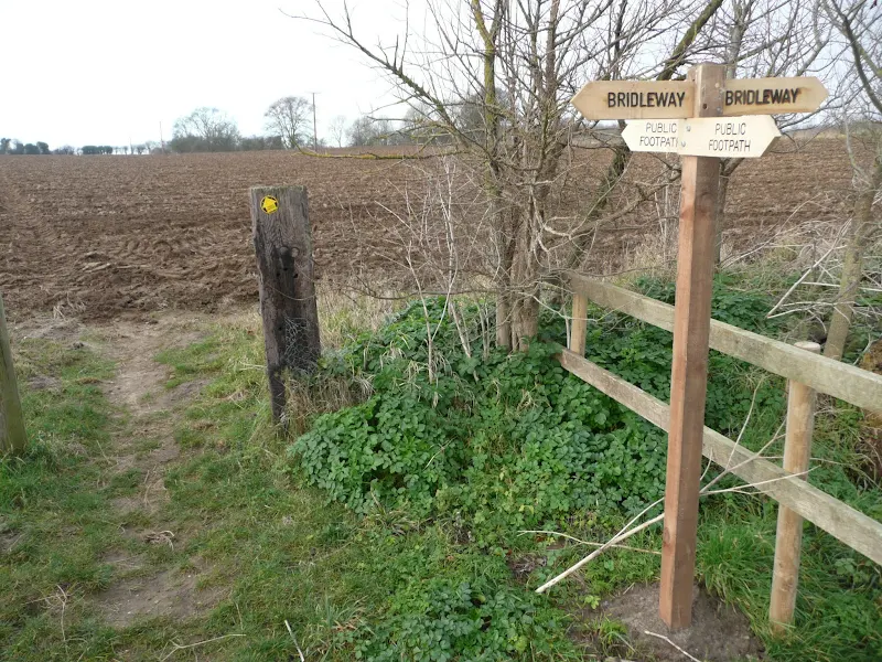
A simple walk using existing footpaths, lanes and tracks all of which are well defined.
Leiston to Friston
Take the B1069 out of Leiston towards Knodishall. As the road curves around an S bend there is a footpath on the right. This leads along the field boundary, under the power lines and into the back of Coldfair Green. At School Lane, turn left then right onto a piece of waste ground used as a car park. Keep to the right and head for a wooden footbridge. Keep to this footpath avoiding all other paths. This crosses Knodishall common then follows the field boundaries until one last open field where it emerges onto a track to Friston. Keep to the track, past Church Farm and continue out onto Church Lane. At the Church, take the lane left and follow the path down the side of the playing fields.
Friston Loop
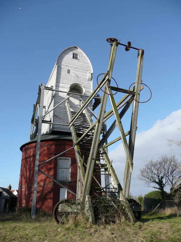
Follow Mill road down the side of the Chequers pub. Opposite Friston Mill there is a footpath across the fields to Friston Hall. This is waymarked with the Sandlings markers. Follow the route past the Hall and the avenue. At the first field boundary turn left and keep to the designated footapth. Continue over the first boundary (marked as the Belts) then at the second boundary, turn left and follow the footpath back into Friston. This crosses the ancient Lime Avenue, an avenue which at one time led from Friston Hall down to the Alde Estuary. The footpath enters Friston on Mill Road. Return back into Friston.
Friston to Knodishall, via Knodishall Green
Opposite the church, on Church Lane there is a footpath that leads out across the fields. This is broad, long and slightly winding path. At Little Moor Farm, the path dog-legs left and right through the trees by the cottages before continuing along the field boundary. Cross directly over the B1119 and keep to the path until it enters a small wood. Half way through the wood there is path on the right to Knodishall Green. Take this, and turn right on the road, then left down the track to the cottage. Buxlow Church ruins is in the rear garden to this cottage and can be seen as you walk just beyond the building. Keep to the footpath beyond which leads back across the B1119 towards Knodishall. At the wood, turn left and follow the boundary of the trees around, cutting diagonally across the bottom field to a footbridge across the stream at the bottom. The footpath emerges onto the road. turn right, then left just before the road goes over the stream. A footpath on the right leads over a small brick bridge and up to the road to Coldfair Green. Keep to the road into the village. The pub is on the right as the road junctions with the main road.
Knodishall to Leiston
Walk back towards Leiston on the B1069 and at the end of the village take the lane on the right. This leads through to Aldringham with the Parrot pub at the end of the road. Opposite the pub is a footpath behind the houses. Keep to this until it emerges onto an open field which it crosses diagonally. Cross the road and follow the footpath around the back of the houses to emerge back on the B1069 in Leiston.
Pubs
The Parrot, Aldringham View in OS Map | View in Google Map

- Address
- Aldeburgh Road, Aldringham
- Website
- https://parrotandpunchbowl.co.uk/
Taken over in 2017 the pub was renamed simply The Parrot
from the more distinctive name of The Parrot and Punchbowl
which, despite its quirky modern moniker, had existed for many centuries. The pub is currently owned by the management team of the nearby Thorpeness Dolphin pub.
The establishment dates back to the 16th century and its more familiar original name was adopted in 1604 when the Kemp family took over the premises. Throughout the ages the pub has been linked to the infamous smuggling stories that surround the area. It was the holding place of smuggled stock with the last recorded seizure being 300 tubs of gin. A tunnel is reputed to lead from the grounds of the inn to Aldringham church. You may also notice a flat stone to the left of the main door of the pub. Once a mounting block, folklore has it that a poor unfortunate shepherd met an untimely death there, his skull later found in a pond that used to be at the back of the property.
The Parrot has changed in recent times, and not only the management but the name with a more trendy Parrot which in my opinion is not good. We all call it the Parrot but it is the Parrot and Punchbowl. Always has been. No complaints with the beer though.
Butchers Arms, Knodishall View in OS Map | View in Google Map

- Address
- Leiston Road, Knodishall
Brick building on the main road through Knodishall. It is interesting to note that several of the early landlords during the 19th century were also butchers which is probably where the pub takes its name from. Originally a Lacons house, the building still retains two of the ceramic Lacons falcons on the exterior of the building. After a period of closures the pub has now reopened and is becoming a popular local renowned for it good food. There are usually three ales on offer with Adnams and Woodfordes being on regularly together with a guest ale. Regular live music, quiz nights and the occasional beer festival are also hosted here.
Always some guest ale on tap here, well worth popping in for a pint
Features
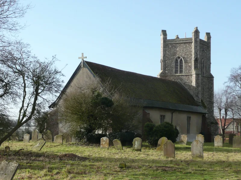
St Marys Church, FristonView in OS Map | View in Google Map
The present building dates back to Norman times though there was probably a church on this site prior to those times. The unusual square tower is from the 14th century though it may well have Victorian additions and renovations. The brick porch is an 18th century addition and the church door dates back to the 12th century. The church bells were installed in 1465-9 and one of these is still in place along with another that is dated 1614The interior is highlighted with a stencil painted walls and roof, the decoration dating from the late 19th century as is the eastern stained glass windows. The eastern window on the south side is said to contain some ancient glass from the 12th century
When entering the church one is immediately confronted by the large coat of arms of James I. This eight feet wide by six feet high wooden carving was found in pieces in the belfry during the 1930s. Alongside the arms is the encased leather and brass cover to 16th century Bible which was found in the old Parish chest.
Buxlow St Peters Church RuinsView in OS Map | View in Google Map
A ruined church from the ancient parish of Buxlow
Standing in the garden of a domestic house named Church Cottage on what is now known as Knodishall Green are the ruins of St Peters Church. This was the parish Church of Buxlow (Buxloe), a parish which was consolidated with Knodishall in 1721. A list of rectors for this church dates back to 1301 when Johes de Melford was the rector. John Hacoun, who was rector from 1393 to his death in 1396 was buried in the Chancel of St Peters.
Documentation records the names of rectors from 1301 through to 1716 which indicates that the church survived the reformation and even the Restoration in 1660. The final name that is recorded is that of Robert Witchingham who became the rector in 1716 when the patrons of the church was Robert Jenny esq. The Jenney family was in possession of the manor and surrounding land from the year 1435.
All that remains of the Church today is a curved flint wall with the outline of a window. This could have been the curved apse of a Norman chancel which faces east towards the distant dome of Sizewell Power Station. Presumably the rest of the church would have stood between what is now the house and some outbuildings at the back of the garden with maybe a tower in line with the house, though this is all conjecture.
An interesting story emerges from the year 1300. At the time Edmund Plantegent, Earl of Cornwall held a knights fee in the parish of Buxlow. A knights fee was a measure of land deemed sufficient from which a knight could derive not only sustenance for himself and his esquires, but also the means to furnish himself with horses and armour to fight for his overlord in battle. Several acts of aggression were recorded between Ralf de Grenham, baliff to the Earl of Cornwall, along with John de Corndebof who assumed the right for fixing the assizes for bread and ale in the parish of Buxlow, to which the privilege fell to the manor of Leiston as it was royal demesne, and that Theobald of Leiston was doing the same without warrant.
Some archaeologists maintain that the area around Buxlow was the location of the Roman fort Sitomagus and that the name Buxlow is derived from the Saxon word for tumuli or artificial mounds which this area is said to once have been densely populated with.
Local folklore maintains that a ghostly shadow can been seen to rise from the ruins of the church and float across the track to go down into the pond on opposite. This tale was related by an old local at Coldfair Green. There may be some confusion here as to the exact location as the nearby Buxlow Manor is also known as Ghost Hole so it may be that this phantom is connected to the old manor house or the pond in its grounds.
References
St Lawrence Church, KnodishallView in OS Map | View in Google Map
This flint and cobble church, possibly dating from Norman as indicated by the blocked northern doorway. The nave and chancel windows probably date from between the 14th and 16th centuries with the tower dating from 1460. The church is flanked with a series of diagonal 19th century brick buttresses. Inside a candelabra hangs from the chancel roof and two brasses behind the pulpit are dedicated to John and Margaret Jenney who paid for the building of the tower. Presumably this is the same Jenney family that were patrons of the church at Buxlow.
Links and Bibliography:
Image Gallery


Route Validation Cards
Validation Date - 2012-01-14
- Time of Walk: 10:30 to 16:00
- Validators: Griffmonster, Kat
- Weather Conditions: Cold but sunny winters day
- Notes: Initial route undertaken
Summary of Document Changes
Last Updated: 2026-04-20
- 2012-01-15 : Initial Publication
- 2014-10-26 : Addition of the local tale of the ghostly shadow at Buxlow Church plus addition of Butchers Arms details
- 2017-02-05 : General website updates
- 2019-01-04 : General website updates and rework notes and rejig route
- 2021-03-17 : Update website improvements and removal of ViewRanger reliance
- 2021-12-01 : Removal of ViewRanger links due to its imminent demise
- 2026-01-12 : Major website update with all walks recast to the new format


1 comments:
Knodishall Green church ruins seem to be on a ley joining Rendlesham church with the Sutton Hoo ship burial. Also on it: Theberton Church, Seven Hills tumuli (east of Ipswich), Stutton Church, and (across the Stour) the ruins of St. Mary's Church (across the Stour) in Essex. I am planning to make a video on this line. Jim Goddard
Post a Comment