Route details, maps, pubs, features, local history and folklore for a wide variety of walks focusing primarily on Norfolk and Suffolk

Walks
Showing posts sorted by relevance for query West Runton. Sort by date Show all posts

Thursday 19 December 2019

In search of the Becks and Ponds of Beeston Regis

View from foot of Incleborough Hill

A 7 mile walk between East Runton and Sheringham in Norfolk, searching out a couple of good pubs and following Beeston Beck across Beeston Common.

This picturesque trail follows the foot of Inkleborough Hill to West Runton then navigates down to the northern end of Beeston Back Common where it follows the stream known as Beeston Beck down into Sheringham, past the site of an old watermill, now replaced by terraces of housing. Return is via West Runton with a stop at the Village Inn. At only 7 miles, this is a simple and easy afternoons stroll.

The Aftermath of the 2013 Storm Surge - Cromer and Sheringham

Damaged Beach huts

A 6 mile beach walk to witness the damage caused by the 2013 Storm Surge at Cromer and Sheringham

Both Cromer and Sheringham bore the brunt of the storm surge on the night of December 5th 2013. Although repair work is well under way there are still the signs of what damage the sea can cause. There have also been many cliff falls along this length of coastline with the cliff faces providing a fascinating view sculptured by the weather and tides and offering multi coloured strata.

Thursday 30 August 2018

Runton and Incleborough Hill Walk Sumary

Salt marsh

Short circular walk over Incleborough Hill in North Norfolk

Incleborough Hill stands above the villages of East and West Runton on the North Norfolk Coast. At 260 feet in height and covered with low level gorse bushes it provides magnificent unobstructed views across the coast from Cromer to Sheringhamm and beyond. One cannot help but be impressed and in awe at the sight.

The walk is not arduous and apart from a short climb up steps it is achievable by most able bodied folk. The return is down a much gentler slope to West Runton and to the coast to follow the Norfolk Coast path back to East Runton.

Thursday 24 January 2019

Folklore Trail around East Runton

Railway bridge at the end of Thains Lane with Inclborough Hill in the background

A 4 mile walk between East Runton and Cromer searching out old folklore

Using country lanes and tracks, this circular trail navigates around a East Runton to visit the various locations in Runtons history and folklore. Woodhill House is the location of an unidentified skeleton found during road widening. Thains Lane has the village's old smithy. The old Windmill sets the scene for the emanation of ghostly lights that crossed over to a copse. With a pub stop at Cromer and return via the redefined course of the Norfolk Coast Path, this makes for an excellent short walk on a spooky Autumn evening.

Thursday 25 August 2011

North Norfolk Railway Beer Festival 2011

The 10th North Norfolk Railway beer festival

There was a selection of 120 ales from around the country plus a range of ciders and perrys all for the price of £2.80 a pint. Entertainment and food was available throughout the weekend together with both diesel and steam train workings to make a truly unique event. Even the rain throughout the weekend could not dampen the enthusiasm of those attending, with plenty of shelter available in the carriages alongside Platform 2 where the beer tent was situated. This was an excellent weekend with ample opportunity for some walking along the picturesque coast to Cromer. There was also a late bus between Sheringham and Cromer calling at Woodhill saving us the walk across Beeston Bump in the dark back to the campstie at East Runton. When it comes to beer festivals you cannot beat this one.

Tuesday 29 July 2014

Norfolk Coast Path Extension

Coastline from Mundesley to Happisburgh

A 21 mile extension has recently been completed to the Norfolk Coast Path taking it through to Sea Palling

As part of the English Coast Path project, the Norfolk Coast path has now been extended to Sea Palling with waymarkers and direction signs being added during the first half of July. This includes a redirected section between Beeston and Cromer that now follows the coast rather than its original route which headed inland through the hills above Cromer.

Friday 20 July 2012

North Norfolk Railway Beer Festival 2012

Beer Festival

The 11th North Norfolk Railway beer festival

Once again the North Norfolk Railway came up with another outstanding beer festival. Over 100 ales plus ciders were on offer in the perfect surroundings of a working steam railway together with live music. Carriages on platform 2 gave ample seating and cover for the few times when rain began to fall and a bbq in a wagon offered hotdogs and burgers. In my opinion the best beer festival around!

Tuesday 24 December 2019

Sheringham to Cromer Circular Walk

An easy 8 mile Norfolk coastal walk along beach and clifftops between Sheringham and Cromer

The Norfolk Coast Path was rerouted in 2014 as part of its inclusion to the England Coast Path. It now navigate alogn the cliff tops for most of the distance along what used to be permissive paths that have now become public. This walk uses both coast path and beach to create a delightful walk along this awe-inspiring section of the North Norfolk coast. Do check tide times and make sure the beach walk is undertaken 2 hours either side of low tide.

Thursday 19 December 2019

Old Coast Path Route - Cromer to Sheringham

Beeston Bump

A 6 mile walk along the original route of the Norfolk Coast Path between Cromer and Sheringham

Up until December 2014 the official route of the Norfolk Coast Path from its start at Cromer Pier through to Sheringham navigated inland along the hills of the Cromer Ridge, the highest ground in Norfolk. This original route can still be walked and contrasts with the cliff-top route of the realigned path which is now part of the England Coast Path. With shady lanes and tracks through the woodland, spectacular views from the summit of Beacon Hill and the challenging ascent to the iconic Beeston Bump, this walk is a worthwhile excursion from the coastal route.

Tuesday 17 December 2019

A Walk to Brancaster Beach

Brancaster Beach

A 3 mile walk out to Brancaster Beach returning across the marsh to Titchwell

Although not included in the official Norfolk Coast Path route, this simple walk is a well worth excursion to witness the expanse of sand and dune as well as a petrified forest and an old wreck. Always be mindful of tide conditions and particularly do not attempt to get across to the wreck which lies across the Harbour channel.

Sunday 31 May 2015

Dads Army Weekend 2015

Dont panic Mr Mainwaring

An easy 9 mile Norfolk coastal walk to visit the Dads Army weekend hosted on the North Norfolk Railway

The third episode of the sixth series of the popular British comedy series Dad's Army was titled 'The Royal Train' in which King George VI was due to pass through Walmington-on-Sea and the platoon were to form a guard of honour. The location chosen to film this episode was Weybourne station on the North Norfolk Railway and each year this is celebrated with a Dad's Army weekend where a group of enthusiasts from the Dads Army Museum in Thetford re-enact this memorable episode.

Sunday 5 January 2020

Wroxham to Norwich via Spixworth

View of the River Bure heading out of Wroxham

A 10 mile linear walk between Wroxham and Norwich

Walk linking the Bittern Railway Line stations of Wroxham and Norwich. The route cuts across to Spixworth using tracks and country lanes from where there is pedestrian access through to the centre of Norwich. Spixworth has an interesting history of folklore which is discussed in the features of this walk.

Sunday 16 December 2018

Alternative Coast Path Route from Sheringham to Cley

View from the hillside between Salthouse and Cley

A 10 mile alternative route for the North Norfolk Coast Path between Sheringham and Cley

This walk takes diversions from the official route of the North Norfolk Coast Path via the North Norfolk Railway and the Weybourne Priory Ruins. A further alternative is then used to navigate away from the strenuous shingle walk along the coast to a more gentle amble up to the village of Salthouse and across the hills to Cley. This provides a scenic and interesting alternative to the official route of the North Norfolk Coast Path and gives some spectacular views across the marshes from the hillside between Salthouse and Cley.

Wednesday 9 January 2019

Salthouse Sculpture Trail

Pond at Kelling Heath

A 14 mile walk around the Salthouse Sculpture Trail

Inaugurated in 2008 by The North Norfolk Exhibition Projects, this trail across Kelling and Salthouse heaths was set out to exhibit both the natural beauty of North Norfolk alongside examples of contemporary Norfolk art. Although most of the sculptures have now gone, the walk nonetheless provides a peaceful route around this part of the county.

Saturday 29 December 2018

Paston Way - North Walsham to Mundesley

Edingthorpe church

An 11 mile walk along Norfolk's Paston Way between North Walsham and Mundesley

The Paston Way is a veritable Trail around some of East Norfolk's medieval churches. This section includes the delights of North Walsham, Edingthorpe, Knapton, Paston and Bacton. Although all are impressive, it it the small church at Edingthorpe which must not be missed, a treasure to behold.

Tuesday 31 July 2018

A Walk to Baconsthorpe Castle Walk Summary

Salt marsh

An easy walk to view the ruins of Baconsthorpe Castle with return route to Sheringham

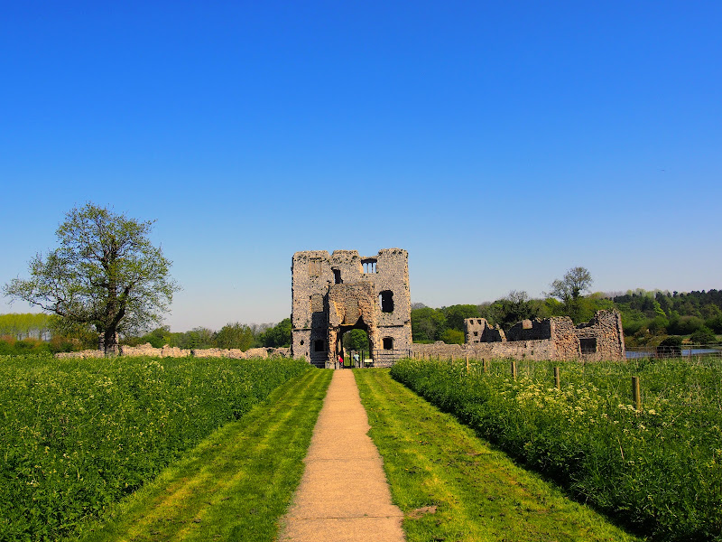
The remarkable ruins of the moated and fortified 15th century manor house known as Baconsthorpe Castle lie to the south of the village of Bodham on the main A148 road close to Holt. Footpaths and lanes provide access through to this isolated wonder that lie hidden in the Norfolk landscape. The Castle is currently under the tenure of English Heritage and entry is totally free. The landscaped area is surrounded by a picturesque moat and information boards document the history of the ruin. This really is something worth visiting so allow at least an hour to peruse this piece of Norfolk history.

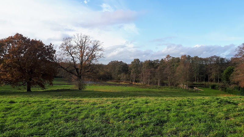
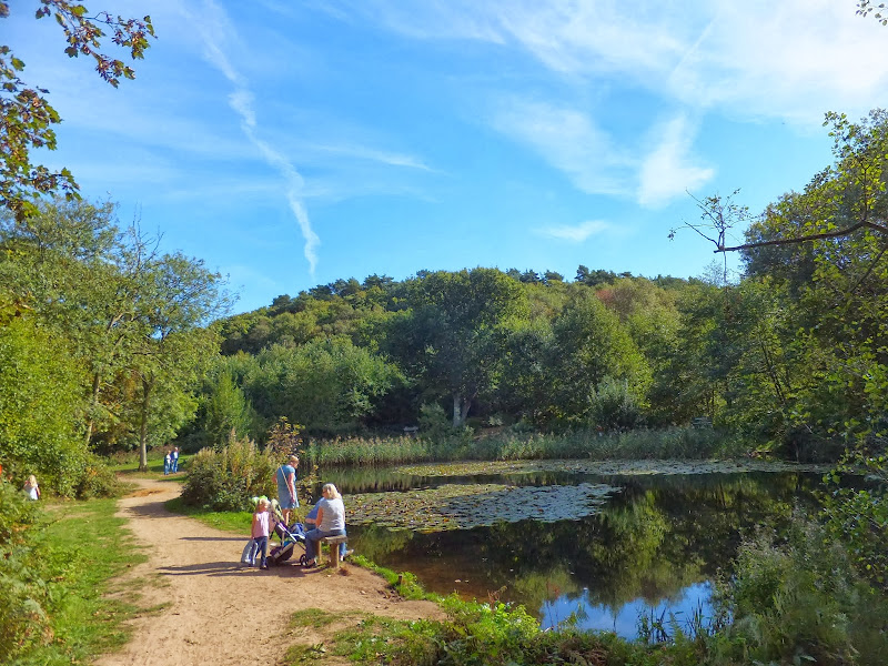
In order to get to the start of the walk, there is a frequent seven day a week bus service linking Sheringham and Bodham. After navigation to the ruins, the return is via the village of West Beckham where there is the Wheatsheaf pub for lunches and refreshment. A footpath leads down to the main road from where permissive paths through Sheringham Park provide an interesting and pleasant route through to Upper Sheringham. This route follows the parks Temple Walk and then continues onto Park Road to emerge back on the road at Upper Sheringham. The park is open from dawn to dusk and outside of these hours one is required to walk down the B1157 which has no pavement making a hazardous route, particularly during holiday periods.

There are pavements between Upper Sheringham and the main town and the walk ends at the bus stop adjacent to the North Norfolk Railway station.

Saturday 28 July 2018

Cromer to Hopton 40 mile Challenge Walk

Salt marsh

Extensive full day hike around the eastern section of the Norfolk Coast Path

This walk should only be undertaken by experienced long distance walkers or those who have specifically trained for such a feat. This specific route was undertaken from 5am with a high tide around 6am. This allowed for a beach walk from Waxham through to Caister as an alternative to the official dunes paths. A support car was employed to provide the return journey and offer assistance in case of emergency.

Saturday 29 December 2018

Mundesley to Happisburgh Circular Walk

Coastline from Mundesley to Happisburgh

A 13 mile walk between the Norfolk coastal villages of Mundesley and Happisburgh

This walk comprises of a circular route taking in both the beach and the cliff-top paths between the two Norfolk coastal villages of Mundesley and Happisburgh. The centre of this walk is at Walcott where the cliffs recede and access to the beach is obtainable. This enables the walker to customise this route according to tidal conditions as both Happisburgh and Bacton beaches can be cut off by high tides.

Wednesday 18 December 2019

Norfolk Coast Path - Burnham Overy Staithe to Brancaster

Brancaster Staithe Quay

A 6 mile walk following the North Norfolk Coast Path between Burnham Overy Staithe to Brancaster

Wide open areas of marshland provide an enticing setting for this easy walk. Sailing boats, marsh, a tidal pool and the site of a Roman fort provide plenty of interest, together with three pubs, what more could one ask for of an afternoons stroll.

Weavers Way - Cromer to Aylsham

Felbrigg Hall

A 17 mile walk along Norfolk's Weavers Way from Cromer to Aylsham

Historic halls, stately homes and ancient commons and villages are what typifies this northern section of the Weavers Way. This really is a typical old English scene throughout making a most pleasurable all day walk. There are numerous pubs along the route which serve both ale and food.

Walk Summaries

Latest walk summaries are basic information sheets for walks that have yet to be fully documented. These provide links to maps, public transport and walks stats, although detailed notes and features are not included.

Latest Walk Summaries

Featured Walk

In Search of Sizewell Chapel

A 10 mile walk following the southern side of the parish boundary of Leiston in Suffolk This walk follows the route of a 17th century peramb...

What is GPX

All you need to know about GPX, electronic mapping and how to use modern apps and mobile devices as navigation devices

Popular Walks

Maps