The Peddars Way - Knetishall Heath to Watton
|
Thursday 24 February 2022
|
1 comment |
![]()

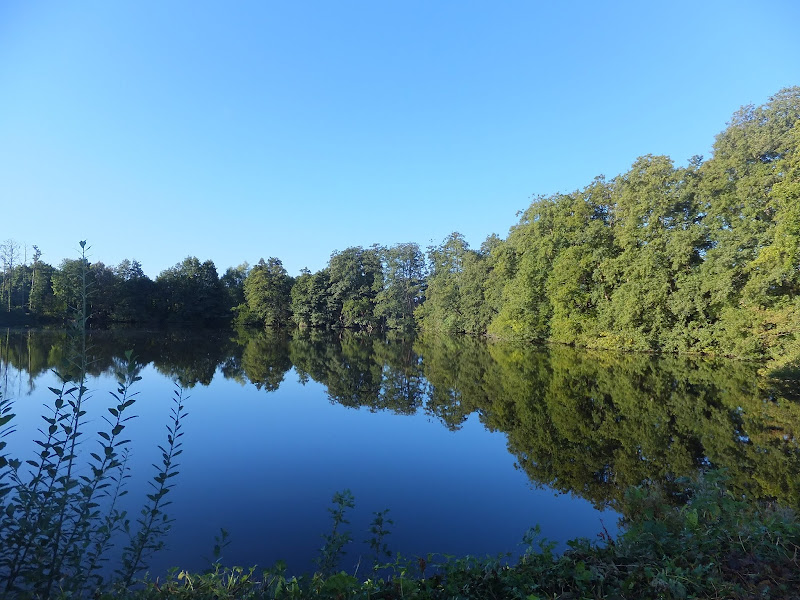
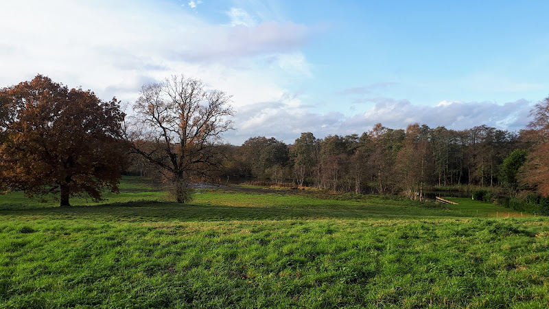
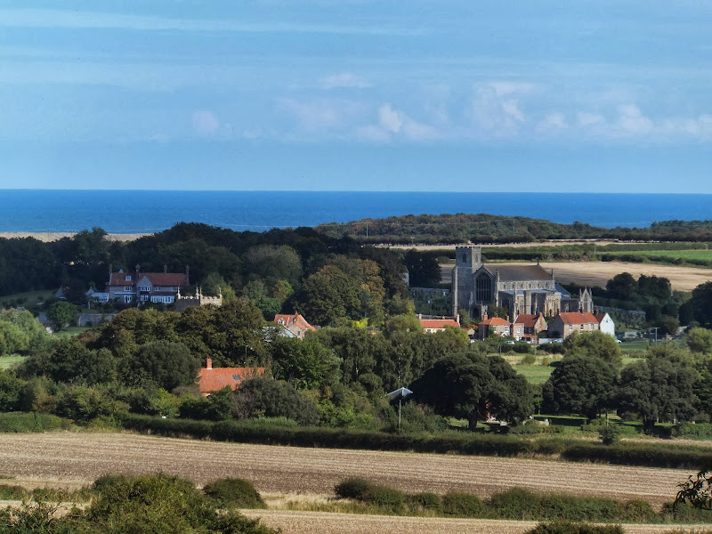
Knetishall Heath to Watton
An easy trek across Breckland on the initial stages of the Peddars Way.
|
Thursday 24 February 2022
|
1 comment |
![]()
An easy trek across Breckland on the initial stages of the Peddars Way.
|
Sunday 23 February 2020
|
No comments |
![]()
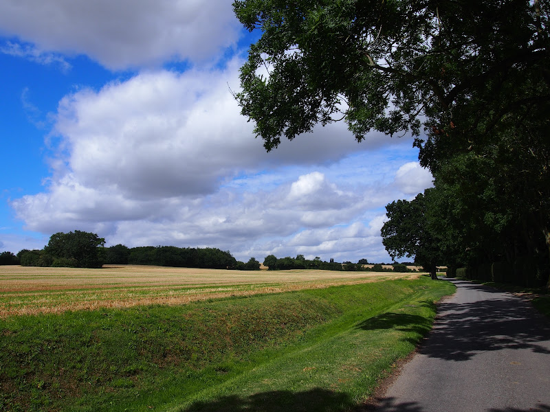
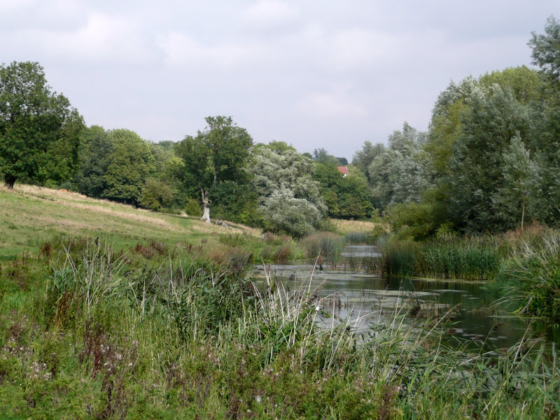
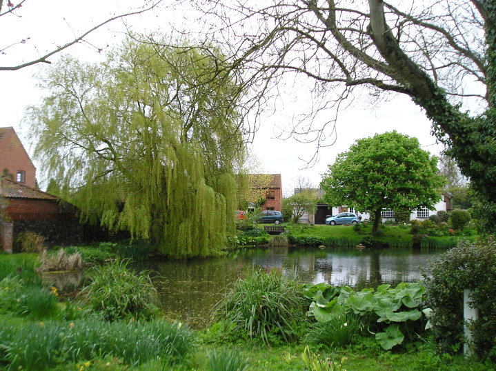
An 8.75 mile walk along the Angles Way from Wortwell to Earsham
It is not often that a country ramble coincides with a Brewery visit. On this route there are two, the historic St Peters brewery and the Waveney Brewing Company based at the Queens Head pub in Earsham. Although St Peters is a little off route a visit to this exquisite old building is thoroughly recommended. Also just off route is the village of Flixton where there is the remains of Flixton Priory and a church with a unique tower plus the setting for a spooky story.
|
Monday 17 February 2020
|
No comments |
![]()
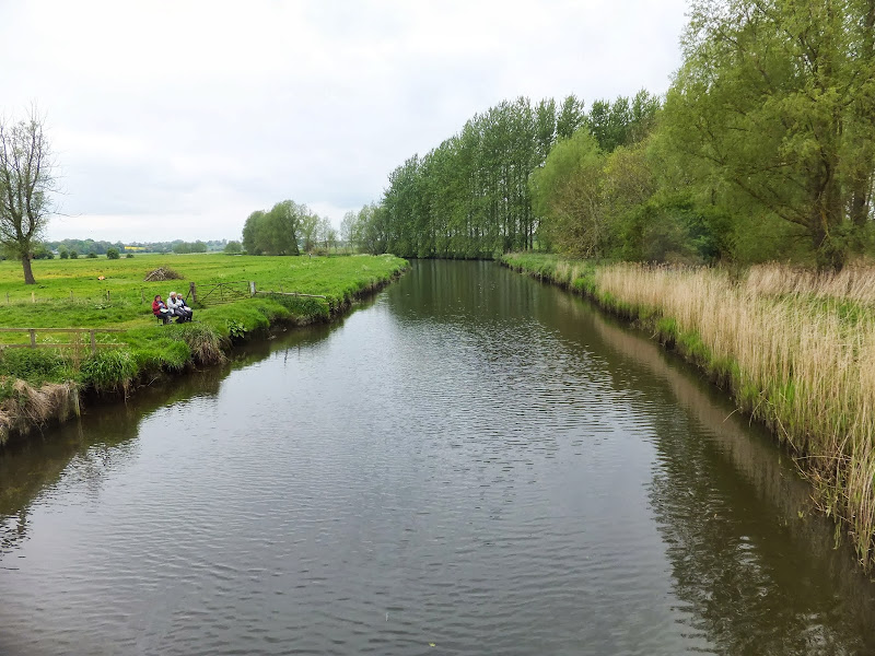
A circular walk through the quintessential Suffolk countryside following the River Alde
A circular walk following country lanes with a few footpaths along the Alde Valley. This is typical Suffolk countryside where one can take a lazy stroll. There are pubs to visit, three to be precise and all named the White Horse, along with three churches that are not named the White Horse!
|
Saturday 25 January 2020
|
No comments |
![]()
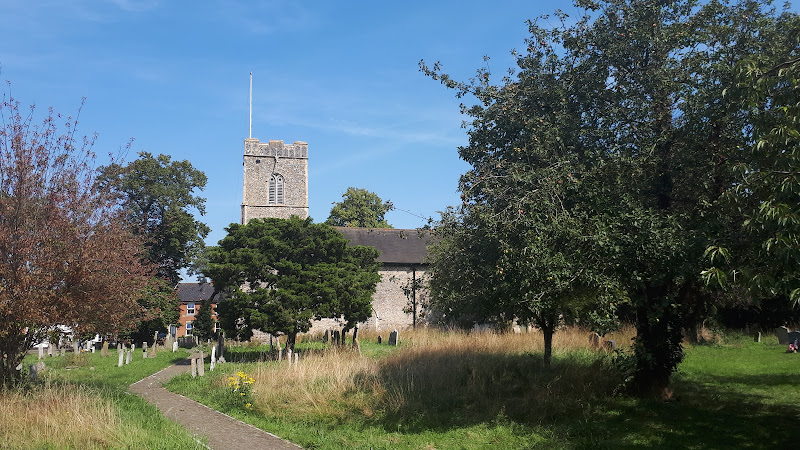
Circular Walk between Saxmundham and the village of Rendham
Six mile circular walk across the Suffolk countryside with a worthy stop off at the White Horse pub at Rendham. Woodland, open fields, babbling brooks make this typical of this part of Suffolk. And there is history to, with the Roman bronze head being discovered in the river at Rendham back in 1907. How did it get there?
|
Wednesday 15 January 2020
|
1 comment |
![]()
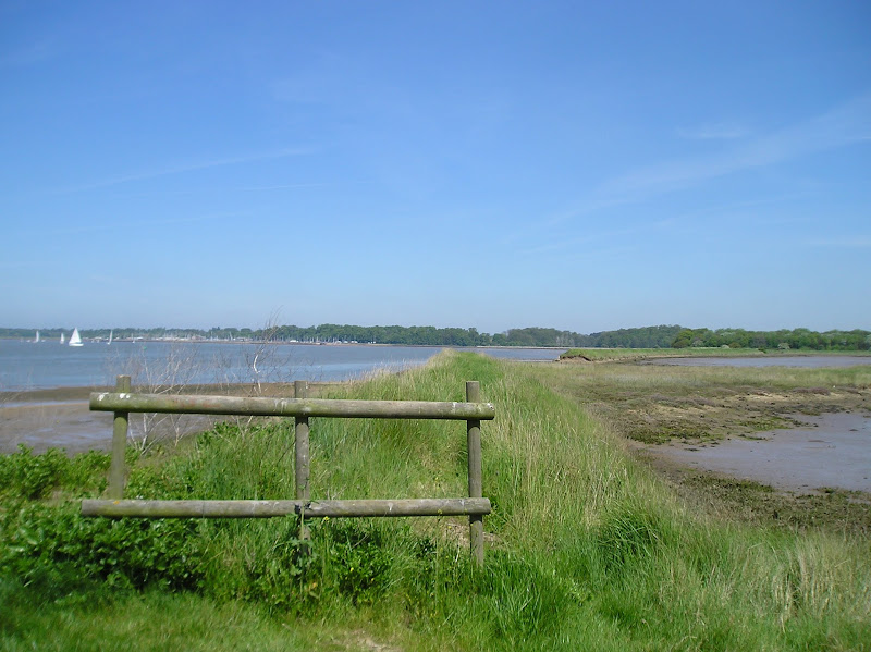
A 17 mile walk along the banks of the Orwell River in Suffolk starting at Felixstowe and ending in the centre of Ipswich
The Stour and Orwell path is an extension to the southern end of the Suffolk Coast Path and follows the coast along the estuaries of the Orwell and the Stour. The start of the walk is characterised by the earthen river defences along which the footpath navigates. From Levington Creek an alternative route is used to pay a visit to the 13th century Ship Inn before proceeding through Broke Hall Woods to rejoin the official route through to Ipswich.
|
Sunday 5 January 2020
|
No comments |
![]()
A 10 mile linear walk between Wroxham and Norwich
Walk linking the Bittern Railway Line stations of Wroxham and Norwich. The route cuts across to Spixworth using tracks and country lanes from where there is pedestrian access through to the centre of Norwich. Spixworth has an interesting history of folklore which is discussed in the features of this walk.
|
Tuesday 24 December 2019
|
No comments |
![]()
A 13 mile North Bedfordshire walk along the Ouse Valley Way between Oakley and Carlton taking in the charming villages of Pavenham, Sharnbrook, and Odell.
Although the Ouse Valley Way does not actually go into Oakley, there is a convenient bus stop here that links the two ends to this walk. The bus stop is a mile or so from the river, from where there is a footpath which joins the official route at Stevington and then winds its way through the rolling Bedfordshire countryside. There's plenty to see and explore along the route with medieval river bridges, the Holywell at Stevington, the ghostly tales of Odell and the picturesque villages of Pavenham, Radwell, Sharnbrook, and Harrold. Although many of the villages pubs have finally closed their doors for good in recent years, there are still convenient refreshment stops on route.
|
Thursday 19 December 2019
|
No comments |
![]()

A 7 mile walk between East Runton and Sheringham in Norfolk, searching out a couple of good pubs and following Beeston Beck across Beeston Common.
This picturesque trail follows the foot of Inkleborough Hill to West Runton then navigates down to the northern end of Beeston Back Common where it follows the stream known as Beeston Beck down into Sheringham, past the site of an old watermill, now replaced by terraces of housing. Return is via West Runton with a stop at the Village Inn. At only 7 miles, this is a simple and easy afternoons stroll.
|
Wednesday 18 December 2019
|
No comments |
![]()
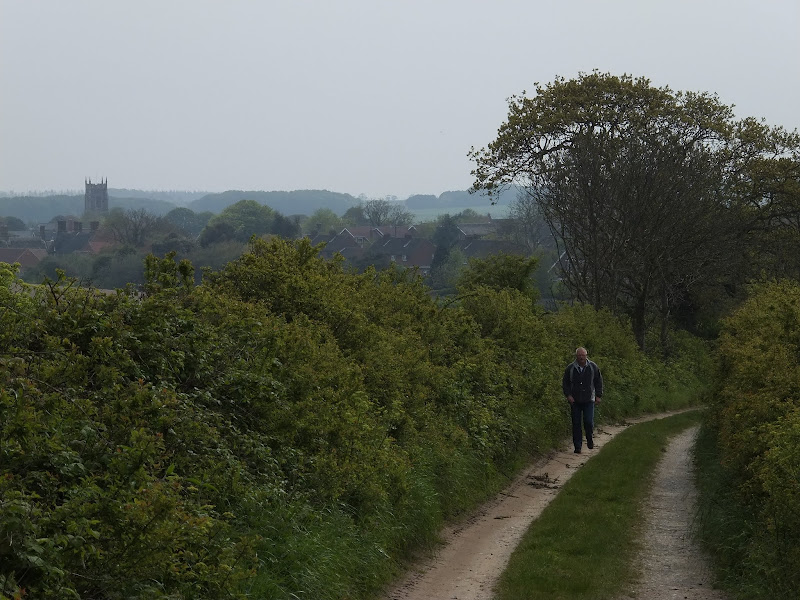
A 7 mile walk along Norfolk's Paston Way from Cromer to Gunton.
The Paston Way has a few alternative paths that stray from its main route between North Walsham and Cromer, and this walk takes the optional route out to Gunton from where a train can be taken back to Cromer. There are some worthy country pubs along this simple walk so a good old English pub crawl can also be had along with taking in the sights of the impressive churches at Northrepps and Southrepps plus local tales of wartime German conspiracies!
|
|
No comments |
![]()
An easy and captivating walk along Norfolks River Bure
Not only does this walk provide some classic Norfolk scenery and historic features but it also traces the route said to be taken by the phantom carriage of Sir Thomas Boleyn in his annual act of penance for betraying his daughter Anne when she was sentenced to be executed. The walk is then made into a circular route by returning via the Bure Valley Path alongside the narrow gauge Bure Valley railway.
|
|
No comments |
![]()
A 6 mile walk taking in the Wiveton Downs as an alternative to the coastal route between Cley and Blakeney
An alternative route to the Norfolk Coast Path between Cley and Blakeney taking in the high ground across Wiveton Downs. Spectacular views of the coastline can be had from this area and the route also includes the Shell Museum at Glandford and the dominating church at Cley
|
|
No comments |
![]()
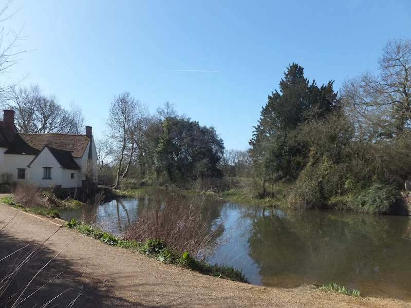
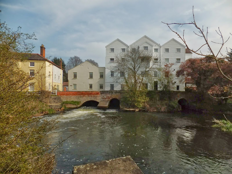
An 11 mile Walk along the River Stour incorporating sections of the Stour Valley Path, the Essex Way and St Edmund's Way
Flatford Mill is the idyllic English country scene encapsulated by John Constables renowned paintings including the instantly recognizable 'Haywain'. This circular route is an exceptional walk by all accounts and the perfect way to engross oneself in this landscape that sits on the Suffolk and Essex border.
|
Tuesday 17 December 2019
|
No comments |
![]()

An 16 mile walk along the South West Coast Path between Bucks Cross and Hartland
An easy start to a walk through the tree covered cliff-tops makes a pleasant ramble through to Clovelly. There follows a couple of challenging valleys to cross and then broad open meadows for more easy walking through to Hartland Point. At this stage the coast turns South to reveal a coastline that can only be described as truly spectacular.
|
|
No comments |
![]()

An 10 mile beach walk from Boston to Wrangle
An alternative route to the coastal defence banks that provides a change to the marsh views. Open flat farmland, tiny hamlets, large churches and plenty of pubs along the way. Not strictly part of a coast path but this route roughly follows the coast of medieval times when Wrangle boasted the third largest harbour along this section of coastline.
|
Monday 16 December 2019
|
No comments |
![]()

An 5 mile walk along the South West Coast Path between Boscastle and Tintagel
A scenic walk that is not too much of a challenge to any seasoned walker. Rocky Valley presents a steep climb in and out but this really is a delight to behold and well worth the effort to get across it. The end of the walk is at Tintagel with all its Arthurian legend. Behold Camelot.
|
Tuesday 10 December 2019
|
1 comment |
![]()
A 14 mile walk along the Angles Way between Belton and Oulton Broad, crossing the border from Norfolk to Suffolk
The Angles Way roughly follows the River Waveney down to Oulton Broad from Belton although there are very few locations where the river can be viewed. Most of the route is across fields, along country lanes and through little bits of woodland. It is a pleasant full afternoons walk with a couple of pubs en route for refreshment. The main place of interest is Somerleyton, named after a peace loving Viking, Sumarlithi, who arrived in the 10th century. It is now a sleepy little village, famed for being the home to Christopher Cockerell, the inventor of the hovercraft, but more renowned for its connection with Gradabor, a giant who once ransacked the area. Some say his ghost still returns to re-enact this destruction.
|
|
6 comments |
![]()
A 7 mile circular walk along the Angles Way from Beccles to Geldeston Locks
A recommended short walk along the Angles Way to the outstanding Geldeston Locks pub, returning via the riverside path to Beccles. This walk passes the location of the historic Barsham Hall, source of the ghostly legend of Old Blunderhazard who is said to ride in his coach drawn by four fire breathing headless horses to Norwich and back each Christmas Eve.
|
|
No comments |
![]()

A 17 mile riverside walk along the Ouse Valley Way between Bedford and St Neots
Despite the increasing urbanisation between Bedord and St Neots, the riverside sections of this walk provide some pleasant rambles. Particularly notable is the 15th century river bridge at Great Barford and the riverside parks at St Neots.
|
|
No comments |
![]()

A 7 mile circular walk connecting the Norfolk town of North Walsham with Bacton Woods
The Norfolk countryside holds a lot of hidden gems and this walk discovers a few. The route uses country lanes and footpaths to provide an easy circular ramble. The woods are worth the effort and hold a hidden secret of the location of a gibbet on which, during the late 18th century, William Suffolk's body was hanged in chains for his murderous deeds. The return route passes the iconic Ebridge Mill and then leads onto the Weavers Way for the final section back to North Walsham
|
Saturday 7 December 2019
|
No comments |
![]()

An 11 mile walk along the South West Coast Path between Perranporth and Newquay
By South West Coast Path standards this is an easy walk along the low level cliffs with no particularly difficult climbs with the usual spectacular coastal views. The main obstacle on this section is crossing the River Gannel estuary. There are three footbridges but these are all dependant upon the state of the tide so tide tables need to be consulted and the walk planned appropriately.
A 10 mile walk following the southern side of the parish boundary of Leiston in Suffolk This walk follows the route of a 17th century peramb...


